An interactive drive through Manhattan
Before Google Street View, I had the crazy idea video tape every single street in Manhattan and make them interactive allowing viewers to freely navigate the whole city with the ability to turn at every intersection. I was also young and naive enough to actually do it, turning into a labor of love over a course of five years.
Planning a route through every street in Manhattan
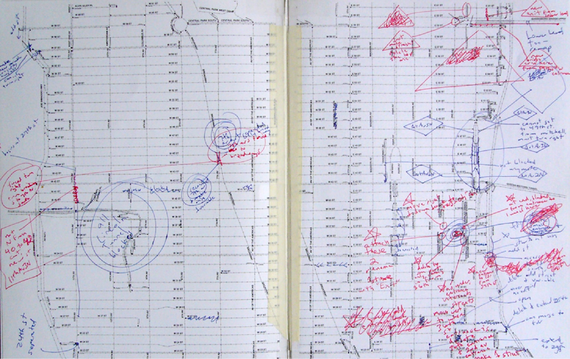
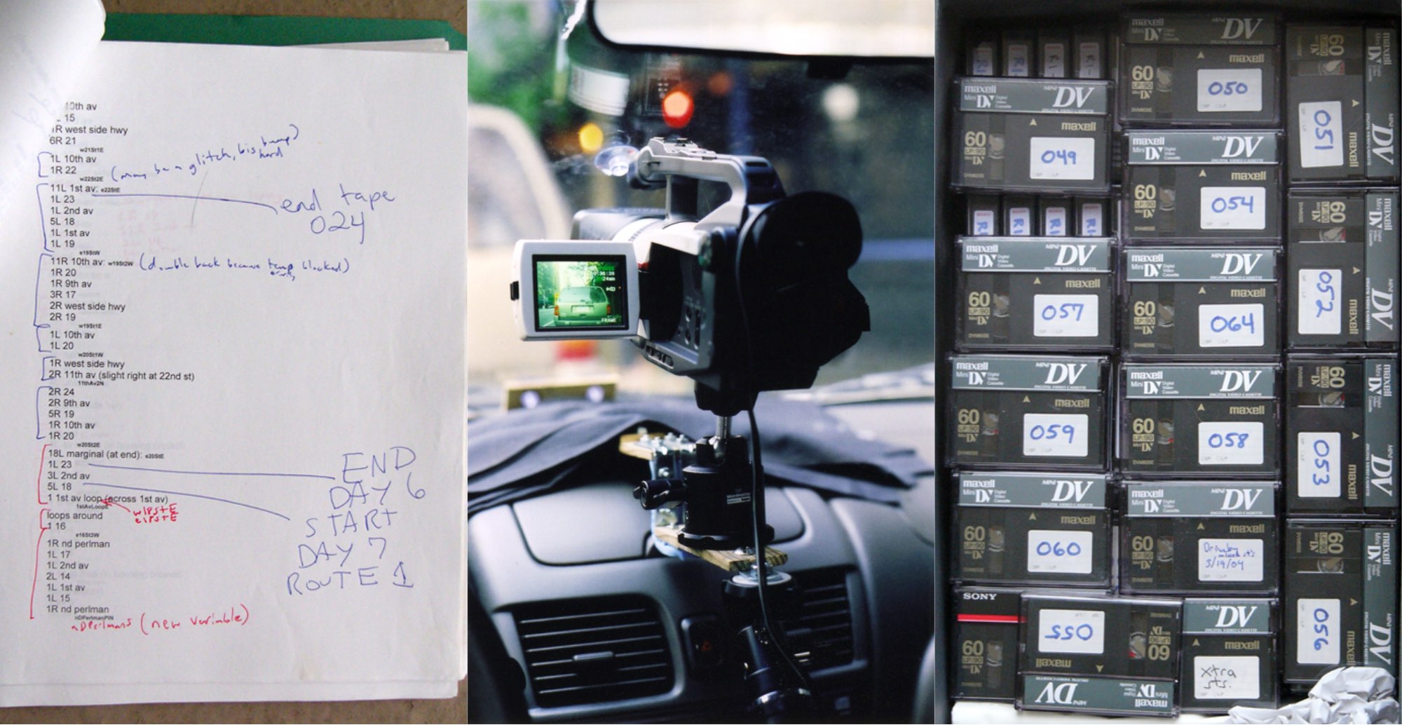
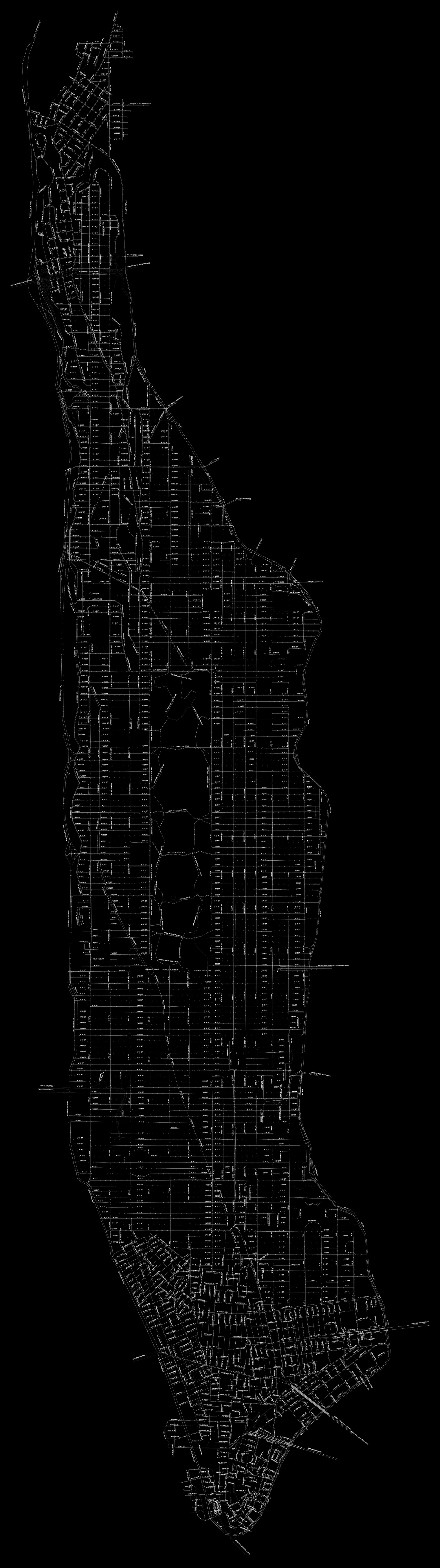
I knew I couldn't simply hop into a car and start taping video. I needed to plot a highly specific course through every street of Manhattan. But before I could even do that, I needed to build my own custom map of Manhattan, as even MapQuest at the time failed in certain areas of complex overpasses, tunnels, and tightly-bunched streets.
I built a custom rig with the at-the-time high def Canon GL1 shooting a whopping 720 x 480 pixels. After a year of planning and preparations, I successfully recorded every single Manhattan street over 10 days of driving.
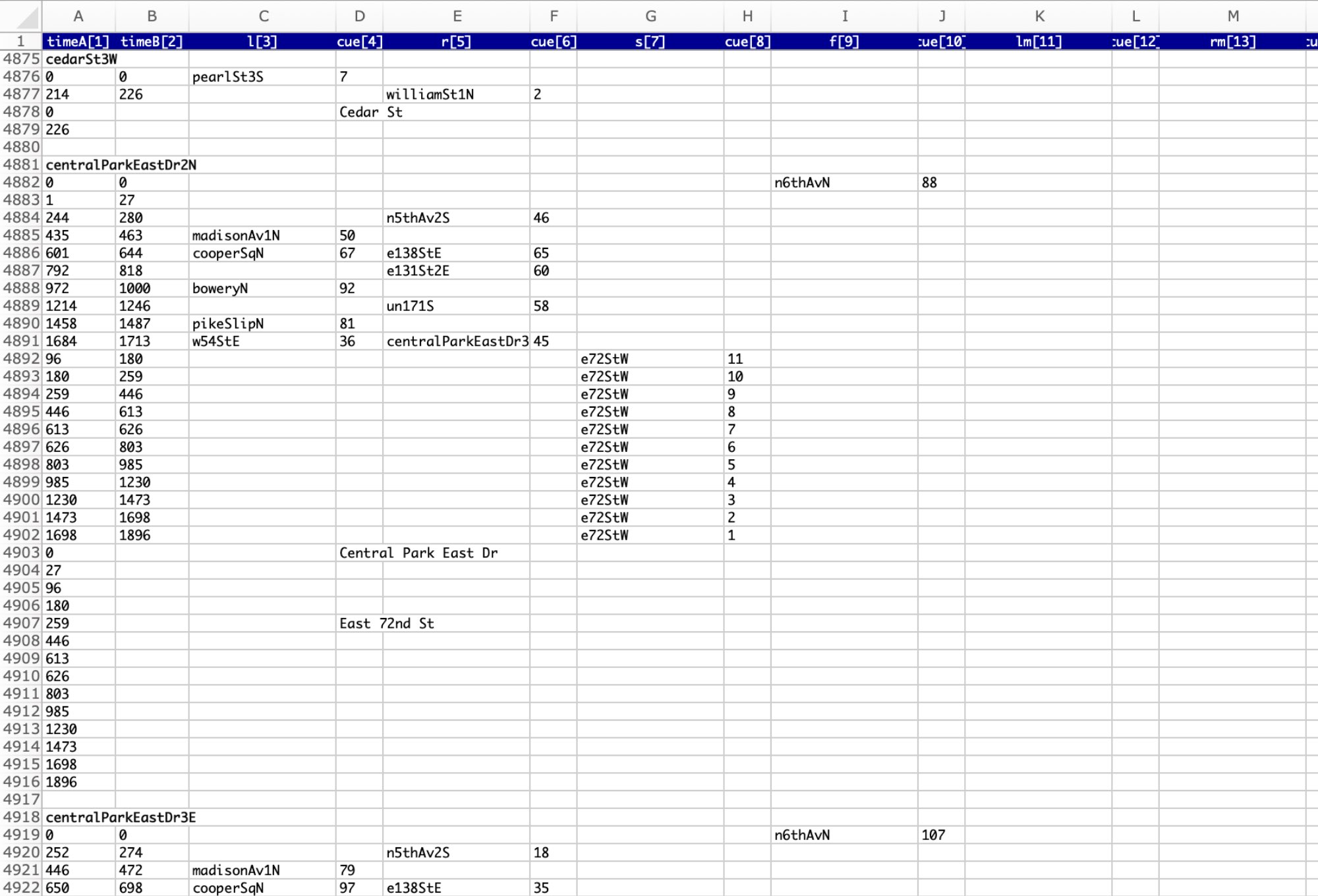
Data points connecting video timecodes to intersections
The next few years, my free time was spent laboriously editing the videos and identifying timecodes at intersections where every street's videos connected.
Fully-vectorized custom map embedded in Flash
I embedded the custom map in a Flash widget that was then embedded in the app built in Macromedia Director.
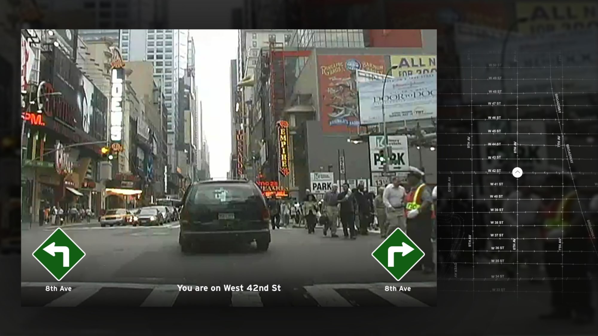
Pulling it all together in Macromedia Director
I designed an interface with keyboard and joystick controls with a large video window and a map on the side with your current location. Signals popped up to indicate the ability to turn at intersections or do a u-turn to drive in the opposite direction.
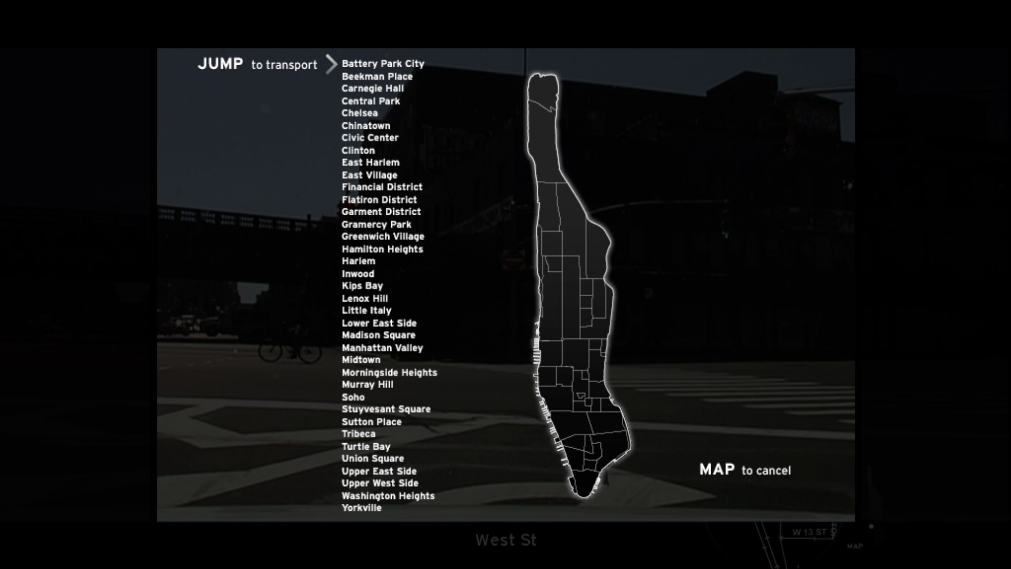
A pop-up menu allowed you to jump directly to different neighborhoods.
Accepted in Ars Electronica 2006
A final build was accepted into the premier Ars Electronica 2006 show in Linz, Austria.

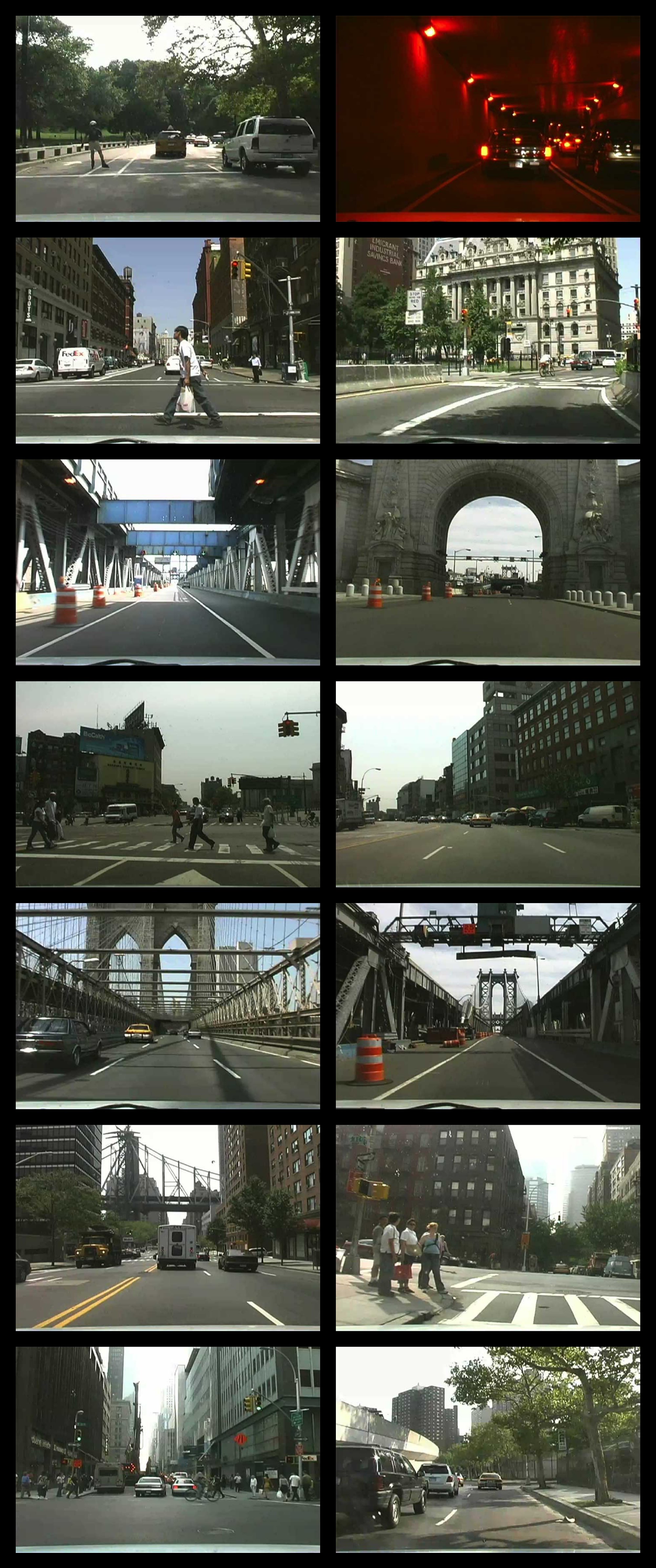
A demo drive
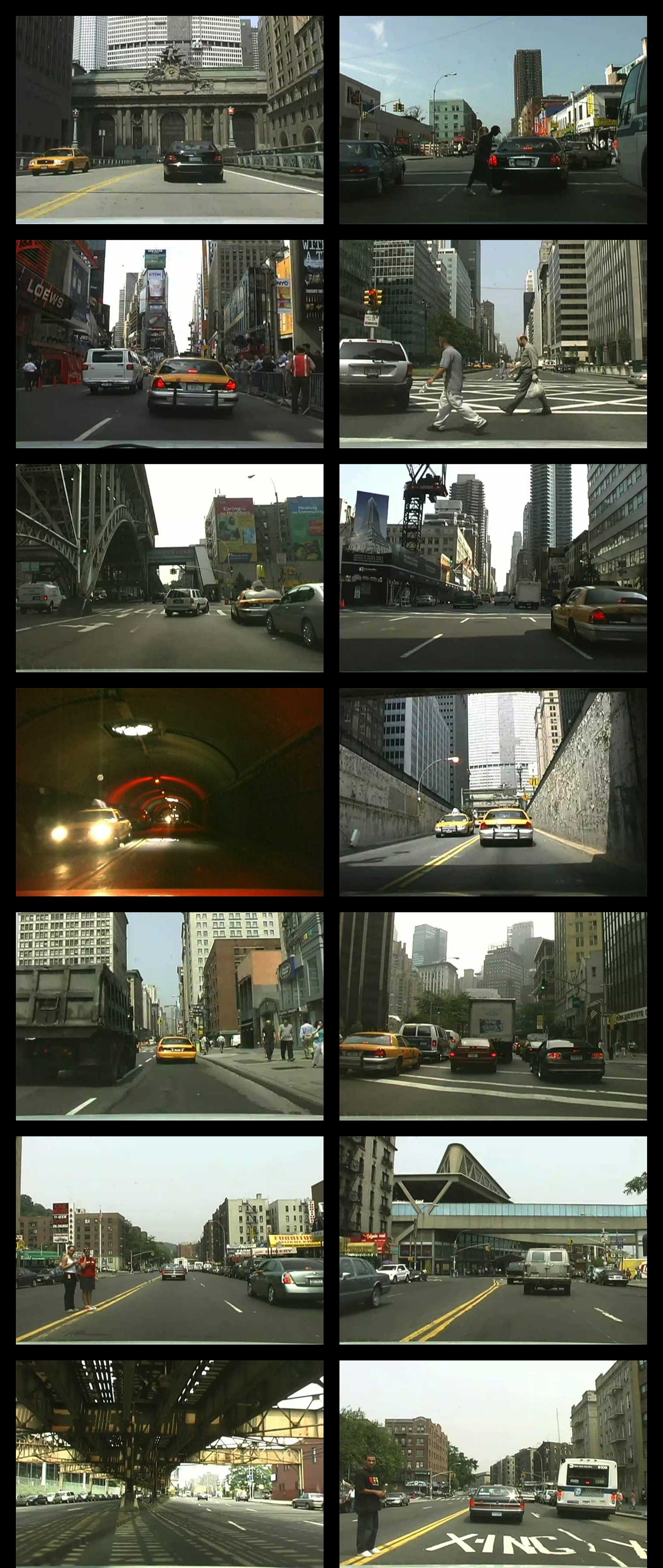
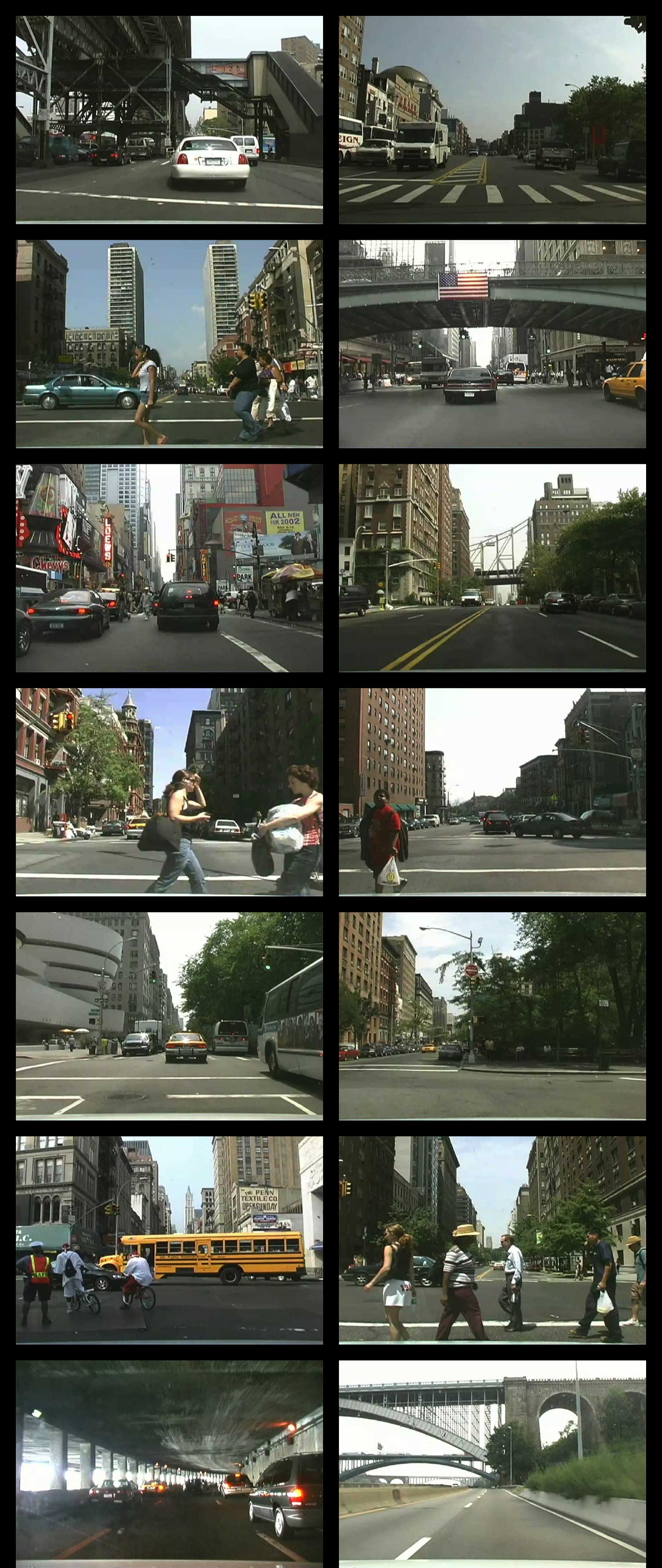
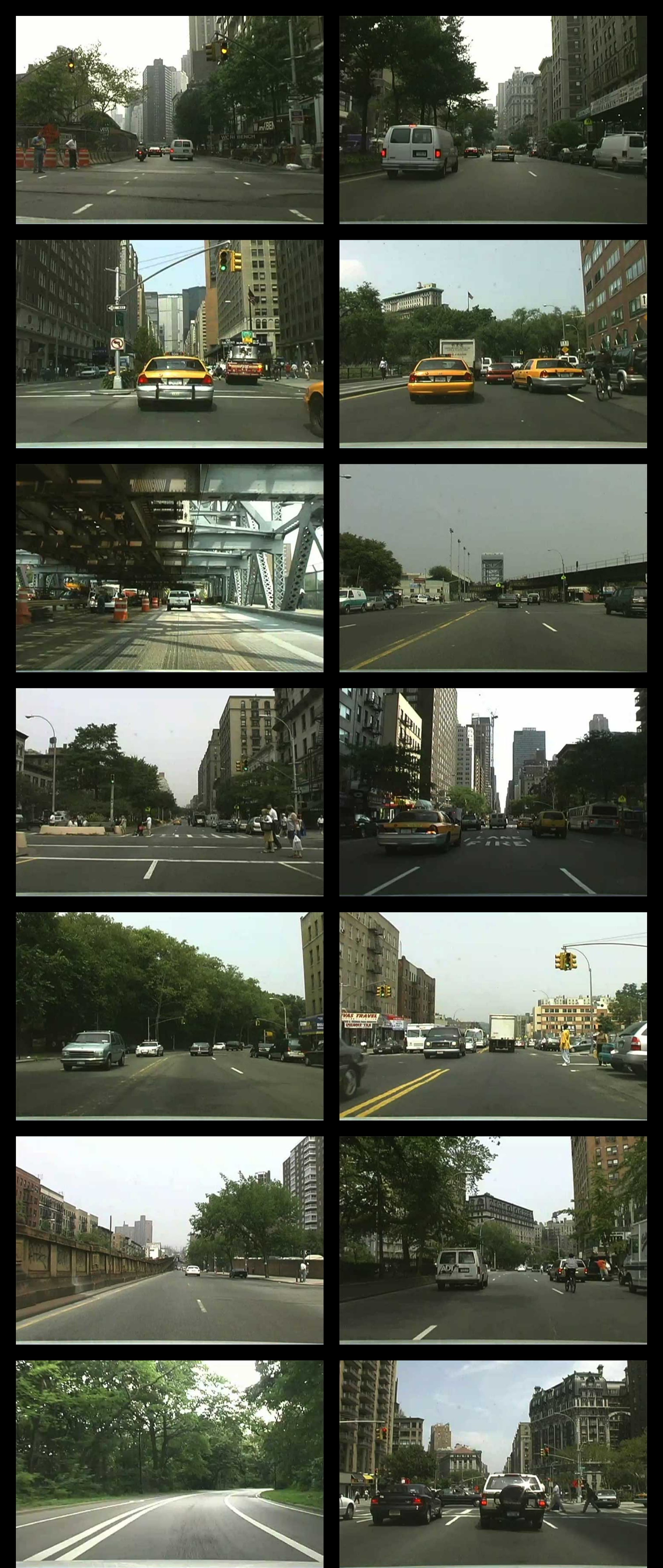
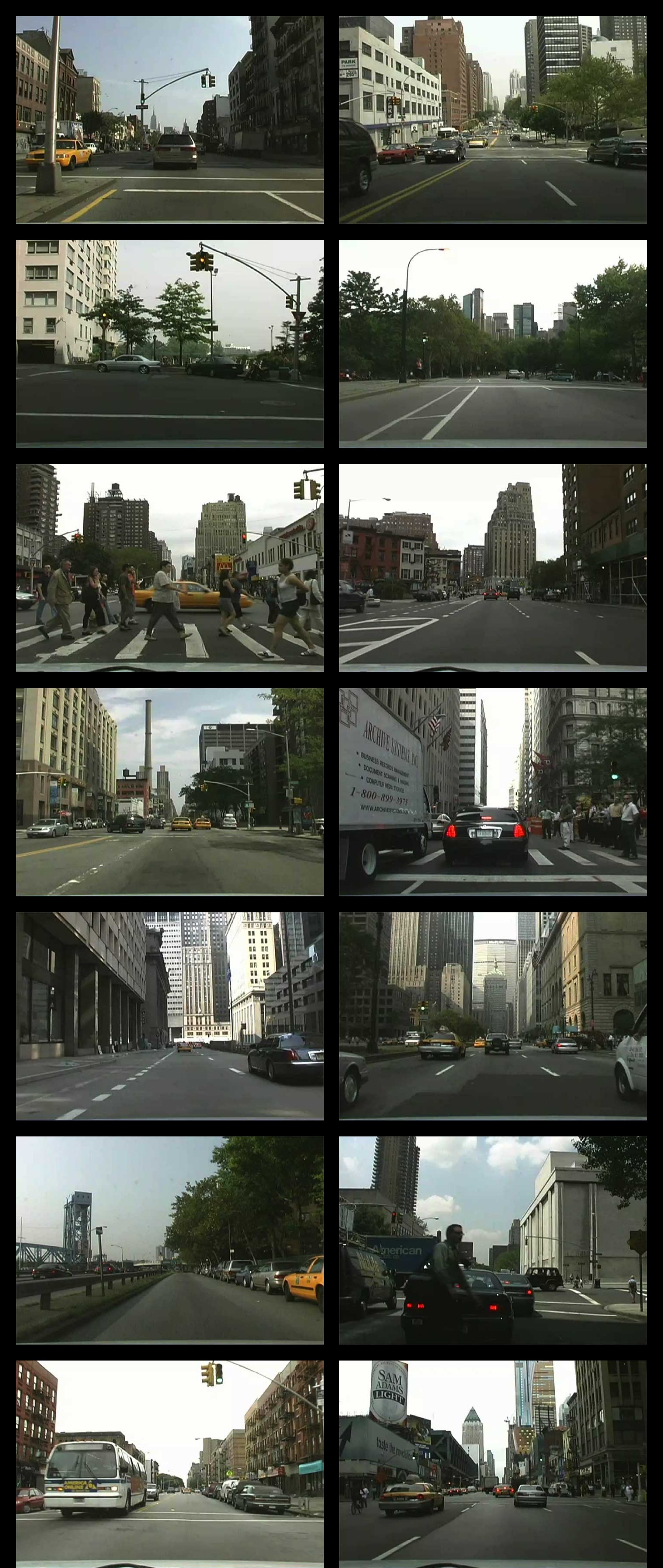
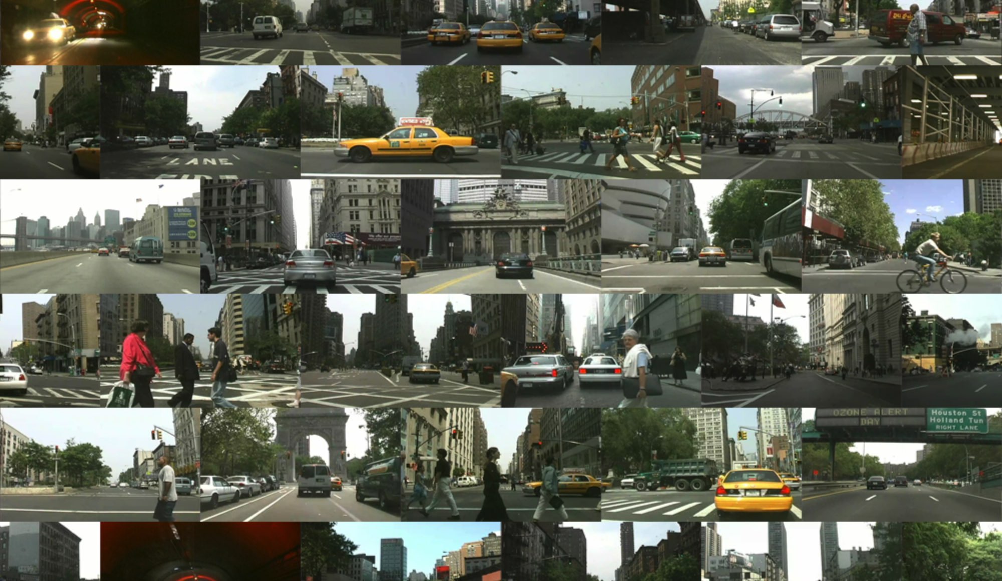
Sample video stills